Sunday, December 8, 2002

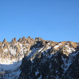
Big Snagtooth

Big Snagtooth, WA
8,330 feet
December 7-8, 2002

Big Snagtooth


Prelude.


At 8330 feet, Big Snagtooth is the 94th highest peak in the State of Washington. It also represents peak number 61 for Pat in his pursuit of climbing the 100 highest in Washington. It would also represent number 6, 6, and 4 for Becky, Kirsten and I respectively should we choose to pursue the 100 highest.

Saturday, December 7, 2002. The approach.

At 5:45 Saturday morning, the horrible sound of my doorbell reverberated throughout my Fremont apartment. I thought all the green stucco and tile on the exterior was going to fall off, which really wouldn't be so bad. Kirsten and Becky waited for me outside as I hurried down the stairs and pushed through the door, nearly making myself a permanent fixture of the doorframe.

Pretty much everything between when the doorbell rang and when I took the first sip of my latte at the 24 hour Starbucks at Northgate is a complete blur. At some point we must have met Pat and switched to his MPV because when I looked up from my coffee he was there and when we walked outside Starbucks, his van was there and our stuff was in it. We continued on up toward Highway 20, stopping first at Darrington for gas, bathrooms, and a Burger Barn breakfast sandwich, which is a fine delicacy that requires 20 minutes of careful preparation. Then we stopped in Marblemount for more gas and reading material for Becky and Kirsten. We were a little stunned to find that there are no magazines in Marblemount. Instead, they had to settle for Star magazine, which looks strikingly similar to a tabloid, but is in fact a wealth of quality journalism and interesting factoids related to celebrities. While pondering the circumstances around the lack of magazines, I sought refuge in a free publication detailing the fascinating histories of the communities in the area.

As we crossed Rainy Pass and then Washington Pass, we were delighted by the breathtaking views of the peaks in the area, and amazed by how dry everything was. We pulled off the side of the road just past milepost 166 and surveyed the territory before us. No trailhead. No trailmarker. No welcome mat. Not even a Giardia warning. Nothing but a landscape of trees and snow. So at approximately 11am we packed up and skidded our way down the bank off the side of the road until we reached Willow Creek. We crossed the creek then followed it up the basin. While in the thick of the trees, the snow cover was thin enough to make the steep slope back up a treachorous surface of frozen, frosty soil. Becky's favorite moment was when she had to perform an aerobic body smear over the top of a slick boulder.

From Big Snagtooth


Once past the steep portion, we stopped for quick break and enjoyed the view of the Liberty Bell Group. The slide alder and fir branches became thick enough in spots to throw you backwards if you gave up any momentum trying to push through. The snow was crusty and a couple feet deep. We postholed and bushwacked our way toward the head of the basin for a couple hours. When there was no vegetation to battle with, this was due to the fact that we were on snow covered talus fields. It was like clockwork, it seemed, that every 10-20 steps someone would plunge thigh deep into the snow, with a foot dangling in the space between two large rocks, followed by an eruption of laughter from the other members of the party. It's a minor miracle that we came away with all 8 of our ankles intact. We stopped briefly for lunch at a small clearing, where we closely inspected Becky's tongue ring. She had a new flesh colored stud on it, which Pat observed looked similar to a pimple. The conversation deteriorated in this manner to the point where we were rolling in the snow laughing.

At around 3:00 we reached a point near the head of the basin and decided to set up camp in a relatively low angled spot below a cliff wall that would be certain avalanche terrain had there been any significant recent snowfall. Pat and I chose a large flat boulder to pitch our tent on, while Becky and Kirsten flattened out a spot in the snow about 30 feet away. Around 4 we began cooking dinner. Kirsten and Becky introduced me to the way of the Tasty Bites, and I must say: I have studied the style, I have meditated on its wisdom, and I have been enlightened! After dinner and a few sips of brandy, we split a cookie 4 ways for dessert. At around 6, the hour was late, and we were tired so we wandered to our tents. Kirsten, Becky and I convened in their tent for a thorough reading of Star, but not before I demolished all of the steps they had made as it appears I weigh more than them. We enjoyed the Star witt and examined our horoscopes, then at about 9:30 we decided that 10 hours of sleep would probably suffice for our summit day and I retired to my own bag. The temperature grew fairly cold, it was 20 degrees when I went to bed, but everyone slept warm and well.

Sunday, December 8, 2002. Summit Day.

We woke around 7:30 and Pat and I each made a nice hot mug of french press coffee, which we graciously offered to Becky and Kirsten, but they chose Cliff Shots with caffeine over the annoying walk over to our tent. We gingerly got ready to go and left camp around 9:30. More difficult postholing ensued. As we approached the ridge to the right of what we believed to be Big Snagtooth, it started to become clear that it was not in fact Big Snagtooth, but actually a peak creatively named "7709." We gained the ridge, then navigated around the summit block of 7709, then dropped down the left side of it to the ridge between it and the true Big Snagtooth. When we hit this second ridge, we were immediately bathed in sunlight, which made us happy, so we knew we were on the right track. After about an hour of traversing the ridge, we were below Big Snagtooth.

From Big Snagtooth


Fred Beckey refers to a gully on the southwest side of the peak. There are, of course, a couple gullies to choose from, and, of course, the correct one is not obvious until you actually ascend one of them and discover the truth for yourself. We chose the first one we came to. It was a fairly wide, inviting gully marked by a very large chockstone near the top. In retrospect we believe that the correct one, to which Beckey refers, is the next gully over, around to the right (if you're facing the peak from the ridge).

In any case, we went up the gully. It was easy going for the first half of it, but then some spots started getting tricky. So Pat threw down a rope for us to tie into at our will, but the rope dislodged several loose rocks from below the chockstone, several small ones of which made a beeline for Becky. One apple-sized rock made the small portion of Kirsten's back that was not protected by her pack its target, briefly knocking the wind out of her. At this point Becky decided that despite all the prestige and glamor associated with a summit of Big Snagtooth, none of that was worth taking a rock in the grill, so she backed off. Once Kirsten got her wind back, we continued on up to the top of the gully.

At the top of the gully it was an easy scramble up to the summit block. The summit block: Beckey mentions the use of a shoulder stand to gain the summit block. It is large, maybe 15 feet by 15 feet, and gently sloping on top. But the top, at its lowest point, is about 6 feet high, and the sides are noticeably devoid of any features that might be used for handholds. So Pat's favorite moment was bracing himself against the wall and serving as a tripod or ladder of sorts for Kirsten and I to gain the lip of the block. It was a pretty scary, exposed move up onto it. Then I belayed Pat up, who had to make the move from the ground.

From Big Snagtooth


We enjoyed the views from the summit for about 5 seconds and then began to set up a rap anchor so we could get down. We summited at around 1:00, significantly later than we had anticipated, due to heading for the wrong point initially and losing time in the gully. So we rapped down quickly. My second favorite moment was doing a single line rappel on a glacier rope with a munter hitch. Once back down on the ridge, we made great time back to camp, arriving in about an hour. We packed up quickly and began the descent back to the road. It is interesting to note at this point that we were motivated by two things, and two things only. One, we didn't want to have to bushwack out in the dark. But it was looking highly unlikely that we wouldn't. So our other motivation was making it back to Marblemount by 7 -- in time to get food from the Good Food restaurant before they closed.

The descent went quickly again, causing as to ponder whether we were better ascentionists or descentionists. It began to get quite dark as we entered the trees with the sun setting, and came to the steep embankment above the creek--remember the one with the really icy soil. One interesting point came as I stepped down over the top of a log. I had nearly completed the maneuver, having both feet below the log, when the tip of my left trekking pole, which I had planted underneath the log, became lodged at the same time that my downhill foot slipped, causing all of my weight to come down on the pole and onto my uphill foot, right leg and arm flailing in the air, and my body bent over sideways to the left. I needed to right myself in order to regain my balance, but to do so, I needed to get my pole loose. So I began pulling hard on the pole with my left hand, in an effort to free the pole, but also to try and pull my body back into balance. In this tenuous position, I was effectively pulling my body toward the pole and vice versa. It is interesting to note at this point that the molded plastic end of the handle on the pole was approximately at head height. It is also interesting to note that a pole can accelerate to a considerable velocity surprisingly quickly when suddenly and forcefully freed from a lodged state. So my favorite moment of the trip came when the pole finally dislodged and the handle, firmly gripped in my hand, hurtled uncontrollably toward my head, coming to an abrupt and painful stop as it connected squarely with my left ear. I tell ya, sometimes I wonder...

We reached the bottom of the basin and crossed the creek with relative ease, then began the ascent back up to the road. "Bushwacking and postholing up a steep slope in the dark," Pat commented. "A true Cascade climbing experience!" Kirsten's favorite moment came as she became entangled in slide alder and fir branches while sinking in postholes. Every effort to remove herself was thwarted by one or the other. After sufficiently battering the brush and the snow with curses, they finally relented and allowed her to proceed. At about 5:00 we finally made it to the road, right next to milepost 166. We laughed gleefully as we saw the shape of a van up ahead in the dark. We laughed more as people drove by and we imagined what they must be thinking seeing 4 tired people carrying large packs, walking down Hwy 20 in the dark. Finally, we laughed with sheer delight as we made it to Good Food in time to order some good food, despite a thick fog that slowed us down and tried to make us miss our good food.

In the end, the climb was not nearly as mellow as we thought it would be -- it was actually pretty interesting and challenging. But most importantly, nothing could stop us from having a great time! There was a short period when we were descending the steep, frozen soil when everyone, including Becky, was quiet, but the rest of the trip was characterized by pretty much nonstop laughter, smiles, and fun. And Pat bagged number 61!

Tuesday, August 27, 2002

Grand Teton

Grand Teton, WY
13,770 feet
Petzoldt Ridge, 5.6
August 25-27, 2002

I. Getting to Jackson, WY

The trip started with a big glitch. Mike and I were scheduled to fly out of Seattle at 4:55pm Friday, and Dave and Andrew were scheduled to fly about an hour later at 6:10pm. In the interest of simplifying things, we planned to drive to the airport together. However, Dave and Andy got stuck in traffic, and so with time getting cut stressfully close, we bummed a ride from Mike's neighbor who he'd met once before.

We arrived at the airport about 4:15, and sailed through ticketing, but then Mike was "randomly selected" to have his bag searched. Mike only brought one bag -- his backpack. Four days worth of travel items, clothing, climbing gear, and food in one backpack. It was amusing watching the security people try to unpack it. It was more amusing watching the pain on Mike's face as they tried to repack it.

They ran the search relatively quickly then we were able to fly through security and we ran to our gate arriving in record time, only to find that our flight was delayed indefinitely. A just turn of events for getting through ticketing and security so quickly. So, we took the train over to Terminal N where Andy & Dave's flight was to leave from and put our name's on the standby list for their flight. There was 1 open seat already, and only 2 people in front of us on the list, so the odds were decent that we'd get on.

At about 5:30 an update for our scheduled flight was supposed to arrive back at our original gate, so we got back on the train and went over there. Our flight was canceled. It was now about 5:45 and the clock was ticking down on Dave & Andy's flight, so we hopped on the train again and went back to N.

Two more seats opened up which meant that I could get on but Mike would have to fly out Saturday morning. We decided to stick to traveling in pairs, so we let the person behind us get on in my place. Shortly after that, another seat opened up, and we kicked ourselves as we realized that if I had just taken that first seat, we would have both got on. Instead we were stuck in Seattle with no other choice but to wait for an early Saturday flight.

So Mike and I, bitter with frustration, got a couple hotel rooms at the Ramada a couple miles from his house, ate dinner at Lenny's, no I mean Denny's, and bought Cinnabons for breakfast, all on Uncle Horizon's tab.

We got a call from Andy & Dave later on. They were in Idaho Falls and they told us they were going to continue to Jackson and pick up our camping permits from the Ranger Station first thing in the morning. That was great because it was a busy weekend and all the campsites probably would have been full if they had waited for us, but it also meant we didn't have a means of getting to Jackson.

We woke early and flew out at 6:20 Saturday morning, and after a couple bus stops in Boise and Pocatello, we arrived in Idaho Falls around 10:30. We had been talking to a NOLS instructor on his way home from Alaska on the plane and he offered to give us a ride to Jackson. When we arrived, his ride was late however, and it would have been a tremendous hassle getting around with no car anyway, so we got a one day one way rental car and planned to meet up with Dave and Andy later.

We cruised to Jackson, and after picking up fuel at a climbing shop in town, we finally arrived at Jenny Lake around 2 and prepared to head up to Baxter Pinnacle.

II. Baxter Pinnacle (elev 8,560+ ft), South Ridge, II 5.9+

Shortly after arriving at the Jenny Lake parking lot, we hiked off toward Baxter Pinnacle. We ran into Andy and Dave on their way back and exchanged pleasantries before continuing on to the boat dock. Mike negotiated a "bad day" discount on roundtrip tickets for the boat ride. Despite this impressive performance, it would be a couple more hours before we realized that there was no way we were going to climb Baxter's and get back to the boat for the return trip before the last run at 6, meaning we would have to hike around the lake.

In any case, we admired the views as we rode across the lake, got the scoop on the local fauna, then hiked up to the base of the pinnacle. We dragged under the thin air and before we started climbing we promised to make sure and keep an eye on each other. This pact was made as a result of Mike failing to put his left leg through the leg loop of his harness on the first effort.

With all the bugs worked out, we began climbing. I led pitch 1, a short class 4, maybe low class 5 scramble to a ledge. Mike led pitch 2, a thin, runout 5.8 face route with a couple fixed pins and very cool moves. I led pitch 3, with a fun, stemming 5.6 chimney. Then Mike led pitch 4, a long scramble up to the base of the summit tower. Finally, I led pitch 5 up the summit tower, with steep, committing 5.9+ face moves right off the deck, then a 5.7 cramped almost-lieback up a crack to the top. The last pitch was short and had 4 fixed pins, so it was more like a sport route than a gear route. Very fun, quality climb, with an easy approach, making it a good first route in the Tetons, especially if you only have a few hours to climb.

But what we didn't realize, but what we would find out over the next couple days, was that the ease of routefinding on Baxter Pinnacle is absolutely not representative of other climbing routes in the Tetons.

III. Grand Teton (the climb)

"Home sweet home" Dave's weary but relieved voice crackled through the radio.

"Great. Have a good night, boys." Mike replied from our tent a couple hundred feet higher up the moraine.

"Bueños noches, amigos."

"Bueños noches. Hasta mañana."

It was about 10:00 Monday night and the c. 15 hour epic was over at last. 15 hours of horrendous routefinding difficulties and confused debating over rock features. 15 hours of climbing, hiking, scrambling this way and that trying to assess our location and the location of the route we wanted. 15 hours of 180° swings in the weather and battles with the thin air above 10,000 feet.

We arrived at the Lupine Meadows trailhead (elev 6,700 ft) and set out for The Grand Sunday morning around 9:30. We humped our heavy packs up the Garnet Canyon Trail to The Meadows camp sites (elev 9,300 ft), arriving around 11:30. Well, some of us humped heavy packs, in retrospect, we appeared to be reenacting the "Heavies vs. Lightnicks (aka Moochers)" experiment in Backpacker magazine. We set up camp underneath a large boulder with two tent platforms, a nearby stream, anti-marmot rope, and the faint scent of human territorial pissings. All-in-all, a very pleasant camp site as long as the wind blew in the desired direction. Unfortunately for Dave, years of negative reinforcement prompted him to pitch his Bibler some 30 feet away to protect us from his nocturnal, bearish mating call. We pleaded that the pleasant sound of the glacier fed stream rushing over rocks 20 feet away would drown out the bear's growl, but he insisted that it was "better safe than sorry."

Having established our domain, Dave and Andy set out to climb Irine's Arête (III 5.8 or 10a) near the Moraine another thousand feet or so above our camp. Mike and I intended to hike up to the Lower Saddle (elev 11,650 ft) between Middle Teton and the south ridge of Grant Teton, then continue up to reconnoiter the starts to the Lower Exum Ridge and the Petzoldt Ridge routes, and time permitting, climb Petzoldt Ridge. We planned to do this to gain a little extra acclimatization and to get a little extra climbing into the trip.

"The future belongs to those who believe in the beauty of their dreams," Eleanor Roosevelt said. And climbing Petzoldt Ridge and getting to camp in a matter of 5 or 6 hours was such a beautiful and absurd dream.

We hiked up the trail toward the Lower Saddle, stopping to talk to other parties along the way. I stopped to indulge my altitude-induced urge to finger paint. Noting a steep rocky bulge splitting the slope up to the Lower Saddle, we solicited beta from one party as to which side of the bulge to pass on. They pointed us to the scree gulley to the right. We could see a wide, difficult looking rock band on the left, so we reasoned the beta was accurate. The beta was NOT accurate. The scree gulley, was a loose, chossy, bowling alley with us as the pins and rocks occasionally falling at random from above as the balls. We gained the ridge a couple hundred feet above the saddle, at which point our memory of reading about the existence of a fixed line to ascend the rock band on the left inconveniently triggered.

Worse yet, from this vantage point almost directly underneath the ridges, we could not distinguish one feature from the next. We could see a band of black rock which we thought might be the black dike, which is the physical feature that marks the point where you break off the Owen-Spalding ("OS") route and head toward the south ridge routes. But if this was the black dike, it was vastly less defined than the black dike on the Middle Teton. So we hiked up to search for more obvious clues. And up. And up. Eventually we ran into a nice family of three that was descending and struck up an enlightening conversation. We asked where the black dike was and they said "way below you." "Huh," we replied, "so then where is the eye of the needle?" A famous feature of the OS route several hundred feet above where we wanted to be, the kind man pointed to the eye of the needle about 20 feet below us. Fortunately, we were only a short way below a notch in the ridge where you pass through to get to the Upper Exum Ridge. We took advantage of our error and scrambled up to the notch and from there could see the Lower Exum Ridge and Wall Street -- two potentially important features of our summit attempt the next day.

Most interesting of all, however, was the thin air. A moderate pace was fine, but making a few quick scramble moves or a sudden step out to catch a slip left us gasping for air and with a pounding heart.

On the way back down we found a magnificent cache in which to store our climbing gear so we would not have to hump it back up the next day. An SUV sized boulder just off the climber's trail that leads to the starts of the south ridge climbs had a 5 foot deep alcove between it and the adjacent rocks where we put our harnesses, rope, helmets, and pro inside a garbage bag and a backpack rain sack. This was a major score and made the entire hike up worth it. However, climbing Petzoldt Ridge was clearly out of the question by this time, so we resorted to just scouting out the starts to the climbs. Dave and Andy had marginally better success than we did that day, having climbed 3 pitches up Irine's before backing off.

Having scouted out the Lower Exum (grade III 5.7 (sandbag)) and even scored beta from an acquaintance from Seattle who is a Teton guide in the summer, we decided that the Lower Exum was a bit too lofty of a goal. So we geared up mentally to try and summit via the Petzoldt Ridge, grade III 5.6.

Back at camp, we cooked dinner and discussed the impact of the new change of accounting guidelines issued in Revenue Procedure 2002-18 by the IRS earlier this year, then solved the crisis in the Middle East before sauntering off to bed and a wonderful night of intermittent sleep and psychotic dreams.

Dave and Andy headed out around 6:45 Monday morning. Mike and I took advantage of our slightly quicker hiking pace and waited until 7:30 to leave. We had to pack up our camping gear and move camp to the Moraine (elev between 10,500 and 11,000 ft), about an hour further up the trail.

The hump up to the Moraine was agonizing. I couldn't get a second wind, my quads felt completely drained, and I feared I had exhausted my energy stores aclimatizing the day before. I decided I was going to take time off from climbing when this was over. But after setting up our new camp and swapping my big pack with my now trusty new summit pack, I felt 10 times better.

We expected to see Andy and Dave somewhere along the moraine, but couldn't find a sign of them. We made contact with them over the radio, but their description of where they were didn't jive with what we were seeing, so we agreed to meet below the fixed line below the Lower Saddle. About half an hour later we contacted them again, having still made no visual contact with them.

"Where are you guys?" Mike called.

"We're below the fixed line." Andy replied.

"So are we. Where the hell are you guys?!"

"We're heading up to the guide hut. Do you have snow to your left?"

"Yes, do you?"

"No. Crap."

Dave and Andy had inadvertantly headed up toward the wrong saddle -- they were taking the approach for the east ridge instead of the south ridge. I made a deal with Andy that I wouldn't be too harsh on him for this, especially because he did make up for it quite a bit later, but I find the temptation quite strong. Let me fill you in on a little background info. Andy climbed The Grand a year or two ago via the Upper Exum route. He had been to the Lower Saddle on that trip. The Lower Saddle is a rather massive feature of the mountain, visible from miles away. Yet he still managed to miss this obvious and large feature by 90 degrees and about a mile! Ay, dios mio! It's hard to discern what we're dealing with here -- the effects of altitude or something more intellectual. Either way, it was quite amusing in restrospect, and turned out not to be a major blunder. There was in fact a hut up where they were going, and they got beta on a short cut from a ranger.

After nabbing our gear from our cache, Mike and I arrived at the base of Petzoldt Ridge about 11:00. We spent about half an hour trying to figure out where the route begins, finally settling on a starting point that seemed to fit the rather vague description in our photocopied pages of the guidebook. We began climbing and shortly thereafter, Dave and Andy showed up over the col between Underhill Ridge and Glencoe Spire to our right. After helping us figure out the route from below, Dave topped off a blue bag and soon they followed us up.

The climbing difficulty was moderate, and we moved fairly quickly even at ~12,000 feet. I won't bother with route/pitch descriptions because unfortunately the routefinding was damn near impossible, and I'm not sure how much of what we climbed was on route. We had to make two traversing pitches in addition to the normal pitches just to stay within the realm of on-route. After a few hours the clouds darkened, the wind picked up, and it began to snail (Dave's term for the soft snow-like hail that was falling on us -- after consulting Freedom of the Hills, it appears it was likely graupel that was falling, but "snail" is much easier to say) and I found myself below a large roof near the end of one of my pitches. I called down on the radio "I found a roof, unfortunately I think it's the roof at the end of pitch 2."

This was a rather daunting prospect and it seemed completely impossible that after 4 or 5 hours, we had only made it to the end of the intended route's second pitch. However, Mike found a small feature on the route diagram that indicated a second roof at the end of the 4th pitch, and after comparing it with our position relative to Underhill Ridge, it fit our visual very closely. According to the book, there should have been a large belay ledge to the left of the roof, and sure enough, when I arrived at the roof, there was a beautiful, large ledge. The snail stopped. The wind died down. And the sun came out and made it nice and toasty. I stripped off my parka and balaclava and basked in the sun for a minute before belaying Mike up.

From here, Mike was able to run his pitch out to the summit of the ridge. Once at the top, we rappeled down to the col between Petzoldt Ridge and the Upper Exum Ridge. The clouds darkened. The wind picked up. It began to snail again, only harder and wetter this time. We climbed the pitch-and-a-half class 4/low class 5 coulior up to Exum Ridge as fast as we could, arriving about 5:30, heads dizzy and hearts ready to leap from our chests. The snail stopped. The wind died down. The sun came out.

It was clear at this point that there was no way we were going to go for the summit. We were about 1300 feet below it, at least 3 hours away, with about that much daylight left. So we began scouting around trying to find Wall Street, which would mark our exit route. Mike found a ledge below us. I found a ledge above us. Both of them could have feasibly been Wall Street, which is a broad ledge traversing a gulley up to the Upper Exum. We had seen it from the other side of the gulley the day before, but now we could not see enough of either ledge above or below to positively identify one of them as Wall Street.

We spent the hour or so waiting for Dave and Andy to arrive lounging and scouting. When they arrived around 6:30, we were getting to the point of urgency. Andy agreed with me that Wall Street must be above us. But I had scouted Mike's theory and was now torn 50/50 on which was correct. I identified a couple horns which could have been used to rappel down to Wall Street if Mike was correct, but it was a good 45-50 meter rappel and if it wasn't correct, getting back up would have been a nightmare.

It was now about 7:00 and we were approaching the point of panic because we had an hour and a half to two hours of daylight at best. We were at about 12,500 feet and were not looking forward to bivying up there, although from some of the meager rock shelters we found, it appeared we would not have been the first to have done so. We could see a couple dozen climbers far below at the Lower Saddle standing around their camps. We imagined they were watching us as well, and the thought only enhanced the feeling of urgency to get down.

So Andy and I decided to scramble up and check out the ledge above us under the logic that at least we could downclimb if it wasn't correct. We had only gone about 30 or 40 feet when the guardian angels arrived across the gulley, descending OS. Mike yelled to them and got across that we needed to know where Wall Street was. Despite a difficult shouting conversation above wind and with pour visual contact between Mike and them, the end result was that they believed Wall Street was below us. Mike called up to Andy and I and told us to come down.

We headed over to the rappel stations I found earlier, set up a rap anchor, tied our two ropes together, and we started the rap down around 7:30. I gladly sacrificed my $6 worth of webbing and biner for the sake of making it back to our tents that night.

"We're going home!"

The ledge below was Wall Street, and it was relatively smooth sailing after that. We descended Wall Street, crossed the gulley and scrambled up to the notch on the OS route. Then we descended OS as the sun went down. We hit the Lower Saddle at about 9:00, just as the last, desperate glows of the sun attempted to dimly color the sky a deep, dark blue from below the horizon. We donned the headlamps, except for Andy who was forced to use a key light having lost his headlamp earlier in the day, leaving booty for the next fortunate party up Petzoldt Ridge.

After descending the fixed rope and negotiating the boulder fields, exhausted from the long day and the altitude, we arrived at Mike's and my tent about 9:30. We gave Andy a headlamp to borrow and asked them to let us know when they got to their tent. Half an hour later those comforting words came over the radio: "Home sweet home."

We dumped our gear out on the ground, ate quickly and went to bed, only to be awakened a few hours later at 4 a.m. by rainfall. We reluctantly got up and went outside in our bare feet in the cold rain and covered up our gear and went back to bed. A couple hours later at 6, the annoying alarm on one of our radios went off from our packs outside the tent. Tired and groggy from a sleepless night on bumpy ground, we chose to endure it's 10 second pattern of rings for a minute and wait to see if it would stop on it's own. It did. We pathetically attempted to sleep some more.

We got up for good at 7:30 and broke down camp and began the long hike down to the parking lot. We stopped to talk to a ranger on our way, and at one point he commented that "the features in the Tetons are very discontinuous and it can take years to learn the routes well." Agreed.

IV. Getting Back to Seattle, WA

Dave is a quiet man. But he is not a quiet man by nature. He is an "intermittent, location-specific extrovert" as Mike Meyers says. After stopping for a meal in Jackson, we continued out to the airport in Idaho Falls. Idaho Falls was home to Dave for 4 1/2 months a few years ago, and he treated us to drinks at his old favorite watering hole. We met a few of his old friends and had a couple beers. Little did we know, the tactful, soft-spoken Dave we had come to know and appreciate, turns into a shit-talking, sarcastic, big mouth after a couple drinks! It was fantastic! And such an unexpected treat. He would make these dry quips, and we would sit there dumbfounded, jaws in our laps, stunned at what we were witnessing, with no clue how to interpret it and much less how to respond to it. The tragedy of the situation is that our inability to process quickly enough made him uncomfortable and after too short of a time, he sealed it up again. But it was reminiscent of the unfamous quote by Barney from The Simpsons, "You should never use alcohol to drown your sorrows, only to enhance your social skills."

At the airport, we were a day early for our flight, so the ticketing agent tried to charge us $75 each to fly standby. That's when Andy came to the rescue and whipped out his Alaska Airlines MVP Club Gold card. That little piece of plastic performed wonders and like a Jedi mind trick (sorry for the nerdy Star Wars reference), the feeble-minded ticketing agent was powerless against it. We had the fee waived and were issued boarding passes on the spot, even though we were 2 1/2 hours early for a standby flight.

Mike had his bag searched again. Then he was searched at security.

We arrived home late Tuesday evening and attempted the impossible task of switching back to the real world. It is difficult sitting at a desk all day when you were sleeping at 11,000 feet on a mountain 24 hours earlier. But, I've just about got this exciting Revenue Procedure interpretation read, at which point I believe I will have rid myself of all the annoying clarity I received during the climb and I can resume life at the desk.

Sunday, July 28, 2002

Mt Shuksan

Mt Shuksan
(elev 9,127 ft)
Sulphide Glacier
July 27-28, 2002

Deb and I headed out toward Shuksan Friday evening, and after solving the puzzle of the climber registration at the Burlington ranger station, we ate dinner and headed up to the trailhead.

On the way up the forest service roads we came across a solitary omen of peace and balance: a 32 ounce bottle of V8 sitting in the middle of the road. We tried not to let it distract our sharp mental state, but it was too much. The questions it begged were so profound and thought provoking, we had to ponder them. Why would someone leave 32 oz of V8 in the middle of a road? More importantly, who the hell buys 32 oz of V8? I suppose the latter question implicitly answers the former, but still, it's bewildering to think that in these harsh economic times someone would dwindle away precious dollars on such filthy swill. I've tried to drink V8 at key developmental stages of my life, only to find that I'm naseously disgusted after the first 3 or 4 oz. But even I have the sense to only buy one of those puney 8 oz cans knowing that the odds are good my reaction will be the same dizzying, mindnumbing, cataract generating, webbed-foot growing, putrid experience as the last time. This begs another mind-boggling question: who is the marketing genius that decided trying to sell V8 in 32 oz. bottles was a good idea? I mean, they have to know that people are going to figure it out within the first 8-10 oz. if not sooner. Well, I guess that makes sense then. Anyway, V8's officers must be sitting in their heavily leveraged offices watching the clock tick down to the time when the entire population figures out that V8 is a disgusting, vile substance and should be banished to the top shelf in the grocery store where even the most unsuspecting victims will god-willing not see the crack-pot health drink and somehow be brought into temptation to purchase it by the attractive label and copious amounts of food coloring. The only good use I can conceive of for the goop is to let it cure and petrify into a salt lick for the local dairy industry. Perhaps this is what the mysterious leaver of the V8 bottle was thinking. In any case, to prevent contamination of the local fauna, we reluctantly picked up the toxic sludge and carried it with us in Deb's 4Runner.

Mental state down the tubes, we were in no condition to offer any help to our next distraction: a couple of guys who apparently tried to drive their jacked up pikup truk off the road a little and done got themselves stuk. Without chains for towing, we were stuk for a way to get them out of their current predicament, and after ensuring they had enough clothes and blankets (and 40 oz'ers) to spend the night, should it come to that, we headed up the last of the road.

We arrived up at the trailhead at 2500 feet, and after tip-toeing around and whispering, trying not to wake up the other climbers that weren't there, we went to sleep in the back of the 4Runner, and graciously donated our warm, thick blood to the local mosquito reproduction effort.

We got up not-so-early Saturday and began the long hike up to base camp. It was an uneventful hike through the overgrown trail in the late morning cloudy gloom. We encountered a few people on their way down, who commented on their summit despite the poor conditions. We were unphased by this because the last weather report we got from NOAA indicated the weather would make a turn for the better late Saturday.

After a few hours we reached the notch where you hit constant snow and begin a long traverse over to the ridge on the west flank of the Sulphide Glacier. We stopped for lunch and within a few minutes a group of Mountaineers showed up. Then a group of Mazamas. We decided to speed out of there in case the camping options weren't abundant.

At 5400 feet, we found the first camp site in a rock outcropping on the ledge. We stopped to marvel at the neatly flattened out tent sites and the compost toilet, then noted that the clouds weren't clearing up. Indeed, as would become a familiar theme througout the trip, visibility was about 100 feet. We decided to continue up to the next camp site at 6500 feet. We followed a bearing based on where we thought the site would be on the map for about another hour, and after gaining the top of a steep slope, we realized we had overshot the camp site and were now at 7,000 feet and at the top of the ridge. Our remorse at wasting 500 feet of energy lasted about half a second. The clouds parted for us and we were immediately and fully drawn into the stunning views of Baker directly ahead and our target just over the rise to the north.

We enjoyed a hearty meal of pasta noodles with the chef's special Alfredo/Parmeson sauce mixture -- we enjoyed it that is until it cooled off and congeled into a jello-like slop that triggered an involuntary gagging reflex milliseconds after entering the mouth. The contentment at having a mostly full stomach was relatively bittersweet. Nonetheless we marveled at the terrific sunset and the amazing way the clouds blew vertically up the west side of the ridge and up and over our heads.

Going to bed we were completely naive to the fact that that was the last time we would see the sun until Monday.

"Is anybody home?" A strange voice called out. A little confused at first, I wondered if he was talking to someone else, then I remembered we were the only ones camping up there. I poked my head out of the tent and outside there was a man traveling solo. It was 7:30am. We had awakened at 5 only to be completely discouraged by the heavy cloud cover. We began to talk with the guy and he expressed his disappointment and disbelief that he was the only one attempting the summit that morning. That meant he had no tracks to follow. We bid him best of luck, godspeed, break a leg, you know the usual formalities, then decided if this fellow could attempt it solo in these conditions, we ought to at least get our arses out of bed and try.

At 9:00, we saw the man coming back down toward our tent. Figuring he could not possibly have summited and returned in 1.5 hours, we were shocked when he began to recount his trip to the summit. Noting some odd inconsistencies between his tale and what we knew of the climb, we bid him farewell, adios, vaya con dios, etc, and he left with the words, "I can't believe I summited in this shit" lingering in the air.

Visibility was about 100 feet (okay, from now on assume visibility is always about 100 feet unless I say otherwise. And very windy). The soloist's tracks were quite clear and we followed them up the glacier. After about half an hour or 45 minutes or so, his tracks ended at a pile of rocks which fit his description of the summit pyramid to a "T." We laughed devilishly and bitterly as we realized the poor fellow hadn't even made it half way to the summit. He was only at about 7800 feet. The rocks were a manky pile of choss that only rose about 20 feet above the snow. We climbed to the top of them to get an exact elevation reading and pinpoint where we were on the map. We were correct in where we calculated we were, but with the poor visibility, the terrain didn't seem correct. We spent the next two hours roaming first to the east then to the west trying to assess the situation and make sense of the inconsistencies.

The big thing that threw us was a very steep slope down about a hundred feet next to the "false summit." We eventually discovered the slope shallowed out significantly about 100 feet to the east, but again, becuase of the viz we totally missed it until about noon.

Totally psyched that we were finally back on our way, we saw the summit pyramid off in the distance after a ways and made a bee line for it. We arrived at the base of it about 12:30. Dropped our packs, crampons and ice axes, and coiled up the rope for a possible rappel. We made a funky, committing step across a moat onto the rock and scrambled some hard grades for about 20 minutes and then reached the high point on the rock. But something was very amiss.

"What's our elevation?"

"7900 feet."

"Doh!" We had barely gained back the elevation we lost when we descended onto the glacier. We had scrambled up the wrong block of rock! We were barely better than the soloist! Completely annoyed with ourselves, we climbed back down.

It was now about 1:00 and we were reaching the point where if we continued we risked hiking out in the dark. We decided that despite scrambling up 2 "false summits," or perhaps because of it, we were going to continue.

We covered a lot of ground quickly and fell into the tracks of another party (they apparently came up the Fisher Chimneys route). We navigated around a couple large crevasses, jumped across a narrow point of another one, then made it up to the base of the TRUE summit pyramid about 2:00.

We dropped our gear except the rope again and began scrambling quickly up. We trended right, gaining the east ridge and enjoyed the view of a sweet steep drop down the other side, then trended left toward the central gulley, climbed up the gulley to the west ridge just a few meters short of the summit, then climbed the ridge to the summit, arriving at 3:00. Emotionally damaged from "false summit" number 2, we were elated when we saw the summit log. No one would possibly put a summit log on another false summit would they?

"What's our elevation?"

"9100 feet!"

"Woo hoo!!!"

We truly had made it. Not an ounce of doubt in our minds this time. Although there were no views to speak of at all, we were absolutely thrilled to finally be at the top of Mt. Shuksan. One of only two parties that summited that day.

Now we just had to get back. We descended straight down the central gulley deciding that all the rap anchors we had passed on the way up wouldn't save us time with a 30 meter rope. Minutes after descending the central gulley, putting on our packs, roping up and heading off, a huge gust of wind hit us. It took our breath away momentarily it was so strong. And it blew a huge thick cloud in that cut our vis down to about 20 feet for a few seconds, igniting my panic fuse for the possibility that the proverbial shit was hitting the fan. Fortunately it eased off and vis returned to the default range.

The rest of the way back to camp went relatively smoothly. We recovered all our wands and managed to retrace our steps back despite them melting out quite a bit. We broke down camp and headed down at 6:00. It was misting when we reached the notch at 4500 feet and the rest of the way down the trail was soaking wet, as where we. The hike back drew on and on and on and on and on.

We made it back to the car just shy of 9:00, beating the darkness by just a few minutes, and avoiding having to classify the trip as a minor epic.

And yet despite all we went through, the V8 bottle had the indecency to stay where we left it forcing us to cart it back to town with us. I mean, who buys 32 ounces of V8, really?


Sunday, July 14, 2002

Eldorado Peak

Eldorado Peak, WA
8,868 feet
July 13-14, 2002

"Big Top Murray"

I eagerly rushed out the door on Friday, with my WAC 2002 Climbing Class diploma in hand, anxious for my first glacier climb since being released into the world. Our trip organizer, Ema, sent me on a mission to acquire the climbing permit for Eldorado Peak. I had to be at the Marblemout Ranger Station by 8:00, and I left Seattle at 4:45. Things went smoothly at first until just before I reached Everett, at which point I slowed to an average speed of somewhere around 0.7 miles per hour. Over the next 10 miles, I sweated and stressed over the quickly lapsing time and the gradually rising temperature of my car. Sitting there in the sweltering heat, as the logjam of cars creaked and moaned forward, I began to question my decision to get a job, which would deprive me of these precious moments.

I eventually arrived at the station around 7:20 and obtained the necessary document. After hopelessly attempting to understand the logic behind needing a Forest Pass to park at the National Park trailhead, I bid farewell to the Park Ranger, and met Mike & Doerte at Goodell Campground.

Saturday morning we all met at the Ranger Station, where we discovered the inevitable had occured, a group of Mountaineers, equal in size to our own, was also bound for Eldorado. Desiring to avoid any conflicts with them, we reviewed the rule of conduct for encounters with Mountaineers: Leave Randy at home. Check.

We arrived at the trailhead with few problems, other than learning en route that despite hailing from the home of the autobahn, Wolfgang and Ursula never acquired the skill of driving fast on dirt forest road.

We set out on the trail at 8:45, and quickly came to our first obstacle, the log bridge across the creek. As we approached the raging river, Scott began to inform it of its legal rights should any of us incur injuries while crossing it, but, upon realizing that it was in fact a raging river and not just a rapidly flowing river, he stripped off his conservative attire to reveal leather and spikey things, pulled out a pint of Jim Beam and began singing "Welcome to the jungle, we've got fun and games..." at the top of his lungs. After Jen beat Scott's ghetto blaster to a violent death, everyone was able to relax and we headed across. Demonstrating very quickly my novicity, I managed to drop both my water bottle and my radio, nearly losing them in the creek.

Once safely across we bushwhacked for a few minutes before starting up the steep trail. We marveled at this trail so noticably absent of switchbacks. In the muggy heat I privately regreted slandering Rob in the Tooth TR, as it appeared that this act had come full circle and turned me into something resembling a wet sponge in a taffy pulling machine.

Hoping for something encouring to anticipate, we occasionally radioed ahead to Mike & Doerte about a half hour ahead of us. We would inquire about the trail description, and Doerte would sweetly repeat the phrase, "It gets steeper, but it's good trail" each time, reminding me of the way my mom would try to make me take cough syrup as a kid.

After a couple hours we reached the 1st of three talus fields. It required great concentration to negotiate the choss in my plastic boots, and consumed copious amounts of energy to keep from whacking Andy with my pack lid as he pranced across the rocks in his tenny runners.

Picking our way through the big rocks, following frequent cairns and some trail, we reached the snowline at the lower camping area around 5400 feet. Happy that after 4 hours of hiking, my plastic boots were finally going to prove useful, I gleefully removed the shells and let me feet unwind. Bastard replaced his tennis shoes with plastics. Deb hooked up to a dialysis machine to remove BAC from her bloodstream from the night before. Murray briefly removed his bandana to check on the progress of his soon-to-become-famous chrome dome tan.

The Mountaineers emerged onto the snow about an hour later, the odor of ten essentials and rigid climbing bureaucracy drifting up on the wind to us, alerting us that it was time to get moving. We proceeded upward and ascended the steep grade onto a ridge separating Roush Creek Basin from Eldorado Creek Basin. Upon reaching the ridge, the guidebook description indicated that we were to "descend on obvious gully" onto the Eldorado Glacier. We all shared a bitter laugh at the obviously collaborated effort of all guidebook authors to perpetuate the use of this deceptively useless phrase. Undoubtedly Oliver Stone is somehow involved. This phrase, which arouses enough skepticism on its own, becomes even less indicative of reality when combined with another phrase such as "marked by large boulder" especially when the entire area you are searching is composed of large boulders.

We found the gully and descended it without too much trouble, although occasional cries of "I'm such a big wanker" and "please make it stop" were heard with striking German accents.

After following the lateral moraine for a while, we roped up in preparation for the ascent up the glacier. Deb made some sort of inquiry, to which Murray offered his priceless and seemingly universal advice, "Just sit down, cross your legs, and be gentle."

We slogged up the glacier to the broad, level area at 7500 feet where we were to camp, and Mike & Doerte greeted us with Mai Tais while we posed for photos with the ship's captain. After tossing him and his worthless ship overboard, we promptly set up our tents and began melting snow and cooking dinner. At this point grave concern grew within the group as we realized that there were no Whisper Lites in the party. We held a pow wow and debated whether or not this was cause for concern. None of us had ever been on a trip where there were no Whisper Lites, and Scott proposed that we abort the climb, citing this as an obvious objective hazard.

Unable to reach a consensus on the matter, we consulted Ema's ouijee board. We sat in a circle around it, hands reaching out to it like a hokey pokey, when if finally responded, "It's a boy." We obviously were a little confused, and Andy suggested the ouijee board was not effective above 7,000 feet. But Deb deciphered this cryptic message, applying the following reasoning: "Brad Pitt is a boy. He drove an El Camino in "The Mexican." "El Camino" sounds kind of like "Eldorado," especially if you say it with a gruff, exaggerated "Mexican accent" like Brad Pitt did in the movie." After a brief pause to absorb this, there was much rejoicing as we began to understand her wisdom and realized that this peak would fall, Whisper Lite or not. It was however, a bittersweet revelation for Murray who wept in dismay at the fact that he humped 20 oz. of white gas for no reason.

In the midst of his grief, Murray tore off his bandana, prompting an uproar laughter from everyone, including himself, at his astoundingly bizarre tan line which made him look a little like Dr. Mindbender from G.I. Joe. Or a scoop of neopolitan ice cream.

Post dinner boredom set in, which I observed leads to a few interesting things on glaciers: 1) People marvel at glacier worms; 2) They discuss the invalid points of "Vertical Limit;" and 3)They build massive snow walls. This latter behavior is especially common when the wind picks up a bit and clouds move in, as happened that evening. Despite building these walls with impressive size and swiftness, our efforts were to be thwarted by the wind, cloud moisture and mild temperatures throughout the night. By morning, just enough of the walls remained to remind us of our foolishness the night before -- kind of like waking up with a bad hangover and finding a strange phone number in your pocket. Not that I know about these things.

I awoke briefly at 5:00 Sunday morning and peeked outside the tent. I could barely see the other tents through the whiteout, so I went back to sleep. At 5:30 Andrew walked around knocking on tents crying "Leeettt's go climbing!" in the style of Pat O'Brien. I overcame my skepticism and looked outside to discover it was perfectly clear. Did it burn off that quickly? Was my perception altered by my desire to sleep longer? Was it an altitude induced hallucination? Wonder will loiter in my mind like bubbles in an IV.

It was a chilly morning and the leisurely, almost catatonic, pace of getting ready for the summit push contrasted sharply to the frenzied, anxious ritual on Baker. We headed out at about 7:00, 15-30 minutes after the Mountaineers. We were both pleased by this and a little disappointed. It would be nice following their steps, but there is also very little room at the summit, and it was easy to foresee a potential conflict between our two large groups.

We descended down onto the Inspiration Glacier then started up again on the other side, reaching a break in the small rock ridge which cuts part way through the glacier. We passed through this and veered up the glacier following the north side of the ridge. We passed several crevasses along the way, some of them relatively harmless, while others looked like they could swallow a Fiat, which of course is ridiculous because a crevasse would never do that.

We reached the summit ridge shortly after the Mounties, despite pausing for 10 minutes or so to allow them time to get off the summit. We headed up the magnificently exposed knife-edge ridge of snow, with nice views of the glacier dropping away on both sides. Soon we donned our balaclavas and switched the ice axes to battle mode, as we prepared for a gruesome conflict. Thankfully, Mike & Doerte pointed out to the Mountaineers the obvious fact that they needed to wait for us to get off the knife edge before they could descend it, prompting a lecture about kinetic energy and conservation of mass from Professor Johnson. We reached a point where it was safe to step to the north side of the ridge and created a second lane around the Mountaineers.

Around 9:00 we all gathered at the small rock outcropping just past the true summit and enjoyed summit chocolate and fantastic views of the North Cascades. Baker, Shuksan, Forbidden, Sloan and Rainier were all clearly visible from this vantage point.

We descended back to camp, packed up and headed back to the parking lot. The descent was mostly uneventful. There were a few nice glissades. Andy successfully defended his title of most daring glissade. We stumbled down the talus fields, then down the steep trail, knees and quads screeching and pulsating like bad brakes, feet hotter than my engine crawling through Everett on Friday.

Back at the parking lot several people rinsed off in the river and Murray removed his bandana. He had rolled it up to make the top edge stop at his tan line in an effort to even it out. Fortunately, the bandana had slipped up on his forehead about an inch, leaving a glorious new logo: a brilliant white stripe running horizontally through his forehead. We enjoyed a hearty laugh and embarked on the groggy drive back to Tacos Pendejos. I successfully avoided the fish burritos this time. Murray, however, did not. He tragically misunderstood my warning about the burritos malos and thought I meant the fish tacos. Despite this unfortunate turn of events, we all left gruntled and joined the rest of the city returning to Seattle via I-5 south.

A more factually correct account of the trip can be found at: http://www.grandcanyontreks.org/eldorado.htm